Файл:Ordensland1410.png

Размер этого предпросмотра: 568 × 600 пкс. Другие разрешения: 227 × 240 пкс | 454 × 480 пкс | 694 × 733 пкс.
Исходный файл (694 × 733 пкс, размер файла: 130 КБ, MIME-тип: image/png)
История файла
Нажмите на дату/время, чтобы посмотреть файл, который был загружен в тот момент.
| Дата/время | Миниатюра | Размеры | Участник | Примечание | |
|---|---|---|---|---|---|
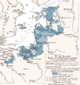
| текущий | 23:47, 2 декабря 2007 |  | 694 × 733 (130 КБ) | Matthead | This map depicts "German rule of North and Baltic Sea in 14th and early 15th century during the height of the Teutonic Order (and the Hanseatic League)" *Ordensstaat possessions until 1410 marked in blue colors, with year of acquisition. *La |
Использование файла
Следующая страница использует этот файл:
Глобальное использование файла
Данный файл используется в следующих вики:
- Использование в be-tarask.wiki.x.io
- Использование в be.wiki.x.io
- Использование в bg.wiki.x.io
- Использование в ca.wiki.x.io
- Использование в cs.wiki.x.io
- Использование в da.wiki.x.io
- Использование в de.wiki.x.io
- Pommerellen
- Neumark (Landschaft)
- Liste der Erzbischöfe von Riga
- Bistum Kurland
- Erzbistum Riga
- Deutschordensstaat
- Preußischer Bund
- Bistum Dorpat
- Litauerkriege des Deutschen Ordens
- Diskussion:Herzogtum Preußen
- Johannes von Wallenrode
- Bistum Reval
- Fürstbistum Ermland
- Jahrbuch Preußenland
- Ostseehandel
- Wikipedia:Auskunft/Archiv/2022/Woche 48
- Использование в el.wiki.x.io
- Использование в en.wiki.x.io
- Использование в eo.wiki.x.io
- Использование в et.wiki.x.io
- Использование в eu.wiki.x.io
- Использование в fa.wiki.x.io
- Использование в fr.wiki.x.io
- Использование в gl.wiki.x.io
- Использование в he.wiki.x.io
Просмотреть глобальное использование этого файла.