Файл:China Tibet Autonomous Region rel location map.svg

Исходный файл (SVG-файл, номинально 2013 × 1137 пкс, размер файла: 1,31 МБ)
Этот файл находится на Викискладе. Сведения о нём показаны ниже.
Викисклад — централизованное хранилище для свободных файлов, используемых в проектах Викимедиа.
|
Краткое описание
| Описание |
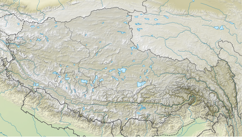
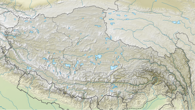
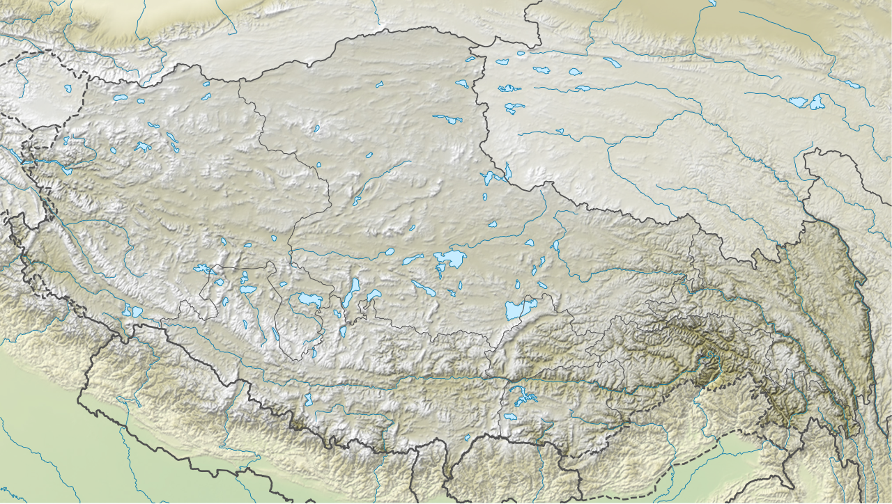
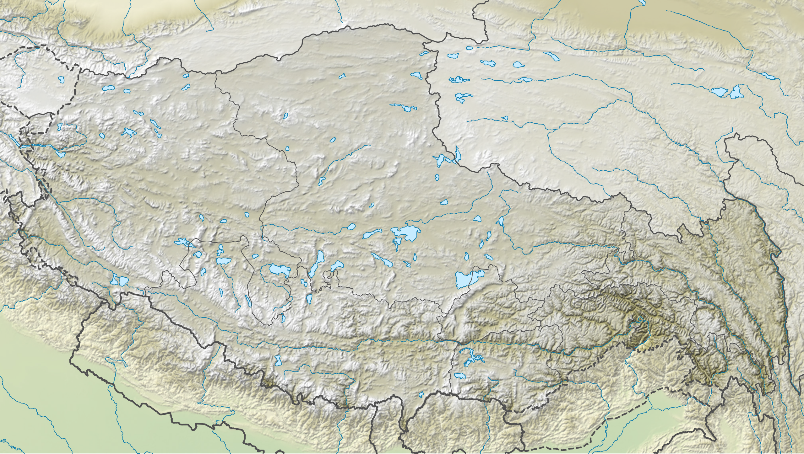
Deutsch: Positionskarte des Autonomen Gebiets Tibet, Volksrepublik China
English: Location map of the Tibet Autonomous Region, People's Republic of China
|
||||||||||||
| Дата | |||||||||||||
| Источник |
Собственная работа, используя:
|
||||||||||||
| Автор | NordNordWest | ||||||||||||
| Другие версии |
|
||||||||||||


|
Эта карта была улучшена в немецкой Kartenwerkstatt. Вы можете также предложить другие карты для улучшения.
|
Лицензирование
Usage of this file with:

explanatory notes: Legally binding is only the full legalcode. For a free usage I recommend to respect the following licence conditions:
1. Provide my name as given above: NordNordWest,
2. a copy of, or the URI for, the applicable license: https://creativecommons.org/licenses/by-sa/3.0/de/legalcode,
3. the title of the work,
4. in the case of an adaptation, a credit identifying the use of the work in the adaptation.
This license and the rights granted hereunder will terminate automatically upon any breach by you of the terms of this license. Any of the above conditions can be waived if you get permission from the copyright holder. If you have questions or wish differing conditions, please contact me through nnwest or my discussion page ![]() t-online.de
t-online.de
- Вы можете свободно:
- делиться произведением – копировать, распространять и передавать данное произведение
- создавать производные – переделывать данное произведение
- При соблюдении следующих условий:
- атрибуция – Вы должны указать авторство, предоставить ссылку на лицензию и указать, внёс ли автор какие-либо изменения. Это можно сделать любым разумным способом, но не создавая впечатление, что лицензиат поддерживает вас или использование вами данного произведения.
- распространение на тех же условиях – Если вы изменяете, преобразуете или создаёте иное произведение на основе данного, то обязаны использовать лицензию исходного произведения или лицензию, совместимую с исходной.

История файла
Нажмите на дату/время, чтобы посмотреть файл, который был загружен в тот момент.
| Дата/время | Миниатюра | Размеры | Участник | Примечание | |
|---|---|---|---|---|---|
| текущий | 17:58, 13 апреля 2020 | | 2013 × 1137 (1,31 МБ) | NordNordWest | corr |
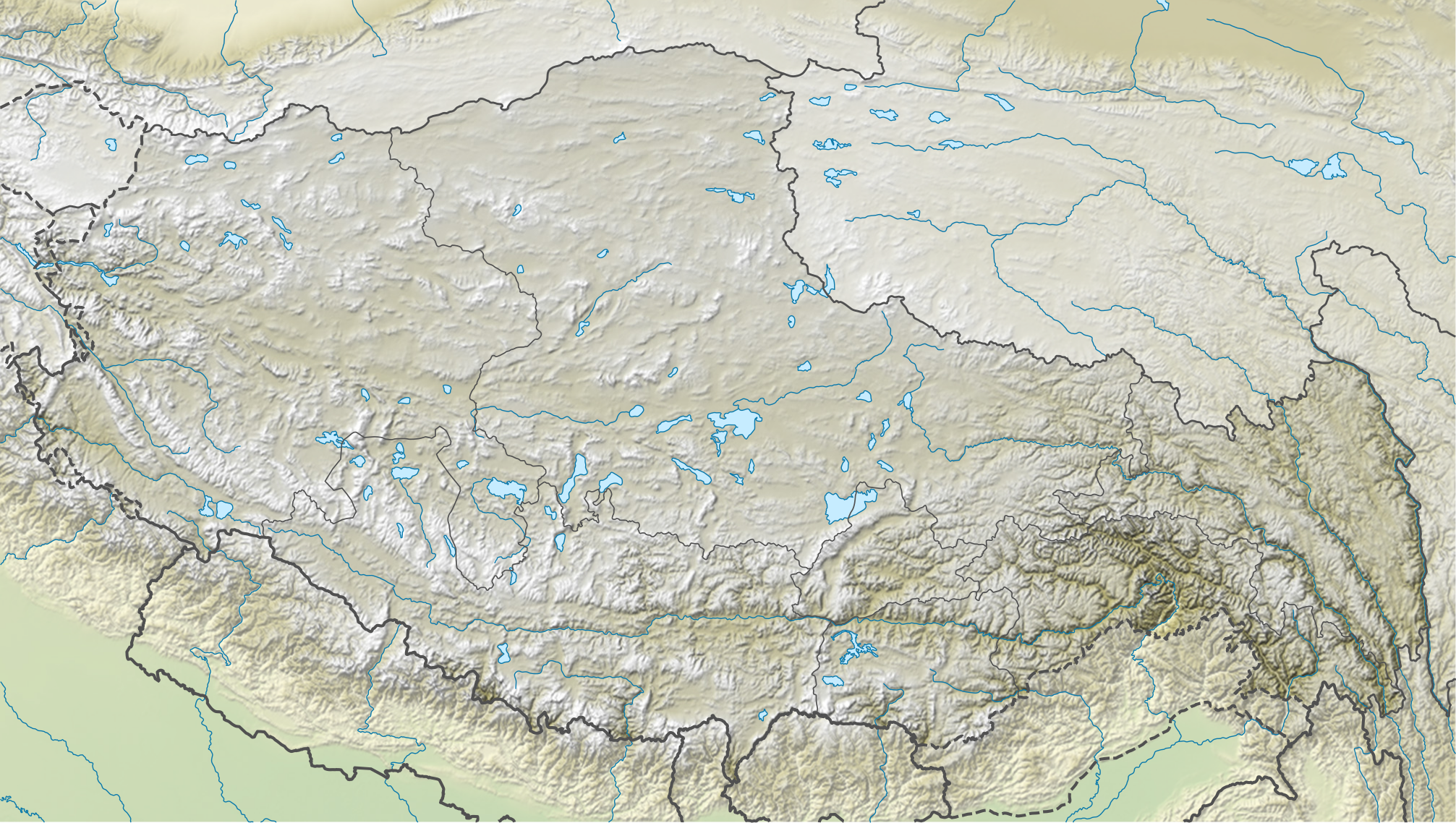
| 19:16, 7 июля 2016 |  | 2013 × 1137 (1,37 МБ) | NordNordWest | == {{int:filedesc}} == {{Information |Description= {{de|1=Positionskarte des Autonomen Gebiets Tibet, Volksrepublik China}} {{en|1=Location map of the Tibet Autonomous Region, People's Republic of China}} {{Location map series N |stretching=118 |top=37... |
Использование файла
Следующие 32 страницы используют этот файл:
- Баирига
- Гангдисе
- Гьесар-Цо
- Гьяла-Пери
- Данграюм
- Кайлас
- Кангшунг (ледник)
- Лабуче-Канг
- Ланга-Цо
- Лхакпа-Ла
- Лхаса (река)
- Мапам-Юмцо
- Мелунгце
- Мигриггъянгджам-Цо
- Намджагбарва
- Ноценкансари
- Ньэнчентанглха
- Ньянг-Чу (нижний приток Цангпо)
- Ньянгчу
- Поронг-Ри
- Ронгбук (ледник)
- Русский хребет
- Сигуанг-Ри
- Силинг-Цо
- Цонаг
- Чабьер-Цака
- Чангзе
- Чангтан
- Чумби
- Эмчу
- Ямджо-Юмцо
- Шаблон:ПозКарта Китайская Народная Республика Тибетский автономный район
Глобальное использование файла
Данный файл используется в следующих вики:
- Использование в be.wiki.x.io
- Использование в bg.wiki.x.io
- Использование в bh.wiki.x.io
- Использование в blk.wiki.x.io
- Использование в bn.wiki.x.io
- Использование в ca.wiki.x.io
- Использование в cv.wiki.x.io
- Использование в de.wiki.x.io
Просмотреть глобальное использование этого файла.